Villarrica National Park
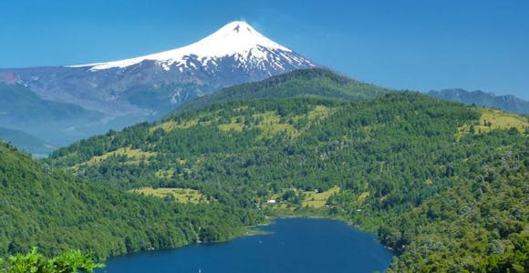
The star power of three volcanoes is what draws visitors to Villarrica National Park on the doorstep of the outdoor sports capital of Pucón.
Discover MoreDeep roots in Patagonia: We are ex-guides, tour leaders, outdoor enthusiasts, & adventurers.
We’ve got our feet on the ground: Impartial advice, a bespoke service, and at no extra cost.
For the ends of the Earth: Sustainability is more than our carbon footprint (but we’re reducing that too).

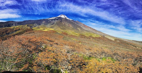
Conguillío is the northernmost national park in Chile's Lake District and is a reserve that has it all: twinkling alpine lakes, thicks forests of beech and araucaria, plunging river canyons and weird desertscapes formed from the ash and lava of its most prominent feature, the ever-active Llaima volcano. Easily reached from Temuco and with good infrastructure for visitors, it's a deservedly popular place for hiking.

Conguillo National Park
Conguillío National Park is thoroughly dominated by the dramatic twin-peaked Llaima Volcano (3125m), not just for its imposing cone but for the way that its lively behaviour continues to shape the landscape and ecosystem around it. Llaima is the second most-active volcano in Chile (its name means ‘blood veins’ in the local Mapuche language) and last erupted on New Year's Day 2008, sending lava and ash across much of the park.
The 150,000 acre park was created to protect the landscape of araucaria trees and southern beech. The araucaria (monkey puzzle) tree was an important food source for the Pehuenche people who lived in the area and collected its pine nuts. Aside from the forests,Conguíllo has patches of dramatic almost lunar landscape formed by volcanic eruptions. Historic lava flows have also damned some of Conguillío’s rivers, creating the tiny but beautiful lakes at Laguna Arco Iris and Laguna Verde. The larger Lake Conguillío, which has some great rocky beaches was also formed in the same way.
Conguillío is a UNESCO Biosphere reserve and part of Kütralkura, the first Geopark in Chile. Its stunning landscapes (particularly when the beech leaves turn gold in the fall), well-organised campsites and proximity to Temuco make it a popular park for visitors.

Hiking in Conguillo National Park
By good fortune, Conguillío’s best trails avoided the outpouring from Llaima’s last eruption. One of the best is the Sierra Nevada trail, accessed from the park’s northern entrance. The 7km trail begins from the eastern tip of Lake Conguillío and heads up into the Sierra Nevada, a low range of mountains capped with glaciers, and offers the most dramatic sweeping views across the whole park.
Starting from the park’s reception centre, the shorter Sendero Araucarias trail leads you through green stands of the iconic trees, and is suitable for hikers of all abilities. The Cañadon Truful-Truful trail, just a kilometre in distance is no less dramatic for its short route, as it leads through a horseshoe-shaped canyon whose strata read like a geological history of the park, from the ancient glaciers to the more recent volcano eruptions. The Truful Truful river at its base leads to a fabulous waterfall.
There are multiple camping opportunities on offer in Conguillío National Park. The northern Curacuatín sector has four organised sites in forest locations, while La Caseta sector has two sites on the shores of Lake Conguillío. The sites have bathrooms but no electricity. There are a further 11 charming wooden lodges, each with their own hot tub.
The best accommodation in Conguillío is La Baita ecolodge, 5km inside the park boundary from the Melipeuco entrance. The lodge is close to several self-guide trails and can organise guides for longer hikes, as well as having a restaurant and sauna to relax in after a day’s exploration.
Conguillío National Park is most easily accessed via Temuco, whose Araucanía Airport (code ZCO) has daily flights to Santiago taking around 90 minutes. There are three entrances to the park, but the most useful for trailheads is the northern entrance at Laguna Captrén around 120km (two hours) from Temuco, via Curacautín. Public buses also ply this route. The southern entrance at Melipeuco is 92km (90 minutes) from Temuco. This entrance also offers good access for hiking trails. The gravel roads are steep and of poor quality for the final approaches to the park reception areas in both locations.
A third entrance in the east of the park at Los Paraguas is best for winter access to the ski resorts.

The star power of three volcanoes is what draws visitors to Villarrica National Park on the doorstep of the outdoor sports capital of Pucón.
Discover More
Spread over the Andean foothills and close to the adventure sports capital of Pucón, Huerquehue is one of the region’s most charming national parks.
Discover More
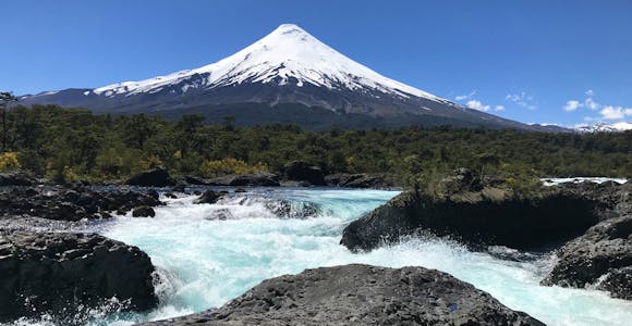
Snowy Osorno Volcano and the blue waters of Lake Todos los Santos usher visitors into one of the most accessible national parks in the Chilean Lake District.
Discover More
Torres del Paine National Park, with its iconic granite Towers, is one of Patagonia's most popular destinations: a paradise for hikers and outdoor adventure activities.
Discover MoreWe'll spend some time listening to your aspirations, then discuss the kind of experience that might suit you.
Next we'll discuss the options, shortlist the best trips for you and present you our impartial recommendations.
We'll place a 24 hour hold on your preferred option - without obligation - whilst we talk through the details.
Whatever your budget, group size, length of stay, preferred activity or appetite for adventure, we can help.
1 888 970 4571This website uses cookies to ensure you get the best experience on our website. Privacy policy